It's wintertime in Europe and the US, and so time to escape the short, cold days. Deep South America seemed like the perfect destination when Stefano, a musketeer from our previous t
rip to the East Coast trail in Canada, and I talked about venues. And I'd been curious about Patagonia hearing it mentioned so many times.
So we planned a Xmas trip to Patagonia and Tierra del Fuego, the island at the southernmost tip of South America that hosts penguins, seals, glaciers and Antarctic explorers. Unfortunately, the third musketeer from our Canadian adventures, Mike, could not make it this time and so Stefano and I bravely set off to see what the fuss was all about.
Our first stop was to be an eight-day circuit of the reddish-granite spires of Torres del Paine, the postcard-peaks of Patagonian Chile.Then the plan was to head further down to Ushuaia, the world's southernmost town, and explore the wilderness around there.
Patagonia
We first flew into P
unto Arenas, a sprawling town just north of the Magellan Straight and got a dose of the wild winds of the Furious Fifties: even a sunny day in the middle of the Southern Summer was periodically lashed with reminders of the extreme geographies of the region: winds blustered constantly and every hour seemed to bring in its own weather pattern.
 |
| Windy Punta Arenas |
The next day we boarded a bus and headed off to
Puerto Natales, a small town on the Magellan Straight that formed a gateway to the Torres del Paine National Park.
We realized how popular and overused the park had become when we got to the park-entrance: there were a half dozen buses packed with European and American tourists. We were given a strict lecture about how to avoid setting off forest-fires -apparently careless campers had set off hug forest-fires in the last few years. The Chilean government had decided to control use of this super-popular destination, and so we had to book camping spots in advance for each of the seven nights we would spend in the park. The visitor center was a super-modern building that contrasted starkly with the corrugated-steel shacks of the neighboring Puerto Natales.
Torres del Paine
With very little idea of what to expect -our planning had amounted to booking camping spaces, bringing our warm clothes tent and stove, and buying 8 days of camping food- we set off. It was to be a 110km (70 mile) loop over eight days that involved about 6 hours of hiking each day. We were promised fabulous views and gusty winds.
 |
| The O Circuit |
Day 1: Las Torres to Camp Seron (14 km)
We set off, excited and energized. We happily realized that we'd be leaving the crowds behind as most people were heading away from us and clockwise on the short, popular W hike. A slow ascent took us through daisy and rhododentron spotted meadows and woodlands. After an hour or so of walking we ran into our first groups of fellow-hikers: a large organized tour of young English and American visitors and a second interesting trio of Americans -Nick, Ray and Carey- who were ending a Paraguayan stint in the Peace Corps with a vacation that included our anti-clockwise circuit around the Torres.
Our first destination at the end of the first day was Camp Seron, and it was our first sense of what camping on the O circuit would be like. The camp had a kitchen and bar supplied by horses and 4-wheelers. We realized that the large group we had encountered had porters who would pack and carry the tents and supplies for them. We also had to register at every campsite. The hiking was strictly regulated to curb overuse and reduce chances of accidental forest-fires set off by careless campers.
We also got a sense for the violent winds and changing weather that would accompany us throughout the circuit while at Seron. Setting up and pulling down camp was slow in these conditions where rain and sun quickly alternated accompanied by constant wind, but we were rewarded briefly by a rainbow over the steppes.
 |
| Rainbow over Camp Seron |
Day 2: Camp Seron to Dickson (19 km)
Our second day was long: it first took up a mountain and then around it which opened up beautiful views of Lake Seron below on the right. The trail then slowly crept down and through many streams and long daisy-filled meadows. While waiting on a meadow for Stefano to recover a misplaced camera I got to discuss cricket with a friendly South African and US fishery with an American girl who was working on a fishing vessel regulating and measuring catch.
The day ended dramatically when the trail dipped into a stream-bed rose up over the steep
bank to a dramatic view of Lake Dickson and the camp ground colorfully decorating a meadow
jutting into the lake. And the highlight was a sparkling blue and white iceberg floating on the
lake next to the camp.
The camp ground had a nice warm refugio with a Xmas tree, beer and Salsa playing in the
background, reminding us that it was the holiday season.
 |
| Camp Dickson Conaf (Chilean Forestry Dept.) |
The views from camp Dickson also gave us an idea of what to expect during the rest of the hike: snow-speckled mountains were all around the horizon.
 |
| Iceberg at Lake Dickson |
Day 3: Camp Dickson to Los Perros (10 km)
A short third-day took us from meadows into a valley with our first close-up views of the
glaciers. We wandered up a valley from with great viws of the steep Andean peaks streaked with ice with snow.
We then crossed into wet forests above a stream. After an hour we finally we crossed the stream at a rapid and ascended alongside the fast-flowing water to a huge glacial moraine. We then ascended the rock-slopes of the moraine to a dramatic view of the glacier Perro tumbling into a milky lake.
The trail wound past the lake, and behind the tall screes surrounding the lake was camp Perro, a quaint, small campground. Here we saw the wild bushy-tailed Arctic fox that more resembled a large dog or wolf slinking around.
Day 4: Los perros to El Paso (12 km, 1,000m)
The hardest day of the circuit took us up, over and down the 1,200 m. John Gardiner pass. The day started off gently.ascending a scree along the left bank of a rapid stream. Soon we enter and exit woods of short birch and ascend above the tree-line to the first patches of snow on the trip. The ascent steepens as we leave behind the occasional woods of stunted trees with tortured trunks
flattened by wind and snow.

Scree alternates with patches of snow with a steady wind which on occasion bursts into gale-force speeds almost blowing us over and leaving us ducking and clutching our hats.
We have all of our layers on and it is a plod up to the pass through rain and winds only interrupted by a ranger annoyed that we are still ascending past noon.
After a couple of hours of walking on very wet rocks, snow, and streams our feet are completely wet. After sighting many false peaks the plod mercifully ends. The top of the pass is a forsaken, wind-blown saddle of rocks, ice and snow with little visibility. We happily clamber down the Eastern slopes to be stopped cold by the sight of the magnificent glacier Gray: a gigantic mass of blue and white ice streaked with grey, ten kilometerswide and twenty long slowly squeezing its way through the massive valley below us.

A long steep descent down scree, then seemingly endless woods takes us down nearly a thousand meters. After two hours of knee-breaking descent that my poles don't survive, the trail evens out and we are at the minimal Campamento del Paso. There are only a handful of campers at this minimal campsite with only a squat-toilet and a non-enclosed cooking area.
It is however Xmas eve, and our Peace-Corps friends and a couple of friendly German guys join us for some Yule cheer, beer, wine and card-games. Our campsite is a small hollow in the hill well protected from the gusty winds and we sleep well.
Day 5: El Paso to Regio Grey


A short hike with constant views of the huge glacier Grey to the right takes us from the minimal campomento Paso to the swank Refugio Grey served by ferries, restaurants and mini- markets. What a difference a day can make!
El Paso is so remote that supplies are dropped off by helicopter. The chopper approached with a gallon of gasoline just as we were passing the drop-off point, and lent a hand holding on to the barrel: tricky stuff.
An easy hike took us to Refugio Grey with excellent views of Glacier Grey all along. We got to see details of the glacier as it piled onto an island, split and sent off large icebergs into Lake Grey. It was interesting to see that the glacier's surface was as marked and crevassed as the surface of hills from the rivers of water that formed when the surface of the glacier melted from the sun's heat.
 |
| The huge glacier Grey |
 |
| An island splits the glacier |
 |
| As far as eye can see |
 |
| The glacier melts into lake Grey |
Refugio Grey was a jarring return to loud, crowded civilization. We realized it was the start of the popular W circuit and our lovely days of peace and quitter were over. We joined the large crowds for beer and cocktails in the swank restaurant that reminded us of ski-lodges.
Day 6: Refugio Grey to Paine Grande
Another easy days hike took us to the very windy campomento Paine Grande that was perched on the edge of a milky-blue lake.
We continued on the trail along the banks of Lake Grey, the large steel-blue lake formed by the melting ice of glacier Grey.
After a while the trail meandered off to the East and away from the grey waters of Lake Grey. Now we could see the peaks and towers of the "Torres" on the left. On the right we passed various smaller lakes, each with it distinctive color.
After descending and walking through a long valley with short woods,
we saw Lake Pehoe, and the large buildings of Paine Grande and its piers that hosted boats and catamarans.
 |
| Lake Pehoe |
Paine Grande was even windier than usual and we were glad to find a camping spot very close to the foot of a hill . We spent the evening drinking wine from the bar there and playing card-games with out Peace-Corps friends.
 |
| Windswept home under the hills |
Day 7: Paine Grande to Campomento Frances (23 kms, 9 hours)
The longest day of the circuit took us from Paine Grande to Campamento Frances with an excursion to the magnificent amphitheater of Valle Frances, a valley that takes you into the heart of the terrific peaks and spires of the Torres del Paine.
It was our first sunny blue-sky day and a leisurely two-hour hike took us to Campu Italiano, a small camground that contrasted with the luxurious "Paine Grande" of the previous day.
 |
| The black-topped red-granite torres |
A winding route from Lake Pekoe and Paine Grande slowly gained elevation and then gave us a glimpse of what was to come. We could see the red-granite torres, capped with black on the right, and forbidding snow speckled black peaks on the left.
 |
| The high mountains of Paine Grande |
We crossed lake Scotsberg and a multitude of small lakes. What was striking was that each lake had it own distinct color: from the dark grey of Lake Grey to the milky blue of Lake Pekoe to the deep-blue of Lake Scotsberg to the pale blue of small mountain lakes. Two lakes next to each other could have strikingly different colors.
 |
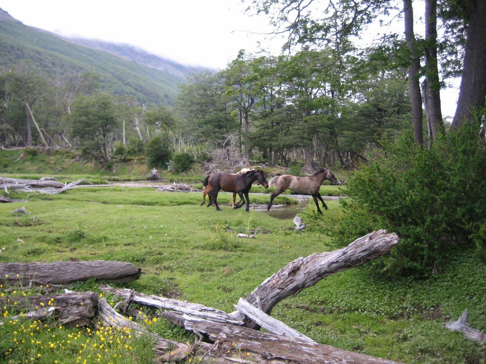
| The Fauna |
We walked along a fast-moving stream and crossed a bridge to Camp. Italiano where we dropped off our packs for the 5 hour excursion up 600 ms. into valle Frances.
 |
| Up and past gushing streams |
The trail steeply went up alongside a thundering rapid over large boulders and soon we found ourselves in the shadow of a towering black peak speckled with glaciers and snowfields clinging to its sides that sent numerous streams rushing down alongside snow and ice.
We walked past a high glacier into some woods that followed a stream into the valley. An hour of walking gently uphill past hordes of tourists on the W circuit brought us to a large glacial moraine. After passing some open areas with increasingly stunning views of the towering peaks and granite-pillars around us, we climbed up steeply to the magnificent amphitheater of Valle Frances.
 |
| The red-granite Torres |
 |
| In the Frances amphitheater |
We were in this magnificent bowl, with towering glaciated black peaks on the left, ranges of mountains and glaciers in front, and red-granite spires on our right. all seemingly near-enough to touch but towering over us. A stupendous show no picture can capture!
 |
| The Grandstand view |
Weary feet took us down, slowly back through the woods in fading light and mist, down through what seemed interminable, steep boulder-fields to Camp. Frances. Our weary feel picked up our heavy packs and pelted mildly by rain we made our way to Camp. Frances.
Te camp was perched on the side of a very steep hill, and tents needed wooden-platforms to afford horizontal space. The long day had left us tired, and after dinner with our American co-travellers from Paraguay we were happy to get into our sleeping-bags after a magnificent but tiring day!
Day 8: Campamento Frances to Campo Torres (14 km)
The exertions of day 7 and the visit to the magnificent Valle Franes left us tired. A long winding trail skirted a pebble-beach on the shores of a lake where the clear waters beckoned us for a swim but the cool winds and tired feet kept us going after a brief stop.
It was a cloudy wet start after saying "Bye" to our Peace-Corps friends. We soon came across Campamento Cuernos which stocked provisions and we were glad, as we had eaten up all the food we had been carrying for the last eight days. After grabbing some sandwiches, we set off on a trail that dipped and rose over many streams that flowed down the mountains on our left to the streams and lakes on our right.
After two hours we climbed some small hills that took us to a vista from where we could see rolling hills carpeted with green meadows and streaked with streams stretching for kilometers ahead of us. At the far distance we could spot signs of buildings and civilization.
Another hour brought us to our starting point at Campo Torres. After 8 days and 120 kms wuth 30 lb. packs, we were back on the Gringo-Trail. After a refreshing beer, we were back on the bus off to the penguin and sea-lion inhabited Antarctic launch-point,
Tierra del Fuego. What unreal and magnificent variety the last eight days had brought us!


