Walking down the Dolomites
After attending my friend Stefano's wedding in the charming town of
Brunico in South Tyrol, I decided to walk through the
Dolomites, the limestone mountain range in the Southern Alps.
The trek, called the
Alta Via 1, starts in the lovely
Puster Valley on the Austrian border and runs about 125 km South and ends in Belluno near Venice, after climbing and descending about 7 km of mountains.
 |
Lovely Puster Valley
|
The Alta Via 1
Lago de Brais to Belluno (55 hours, 120 km South, 7 km up, 8 km down)
 |
| The Alta Via 1 |
The Start: Lago di Brais
I took the local train that connects the various steep valleys in the Brunico region to the Puster Valley region and then a bus to the lovely Lago di Brais in the morning. It was the early season, so people were few and far between. I started out with the lovely lake and mountains practically to myself.
 |
| Lago di Brais |
 |
| Rifugio Sennes |
Day 1: Red Lightning
Lago di Brais to Sennes (4 1/2 hours, 8 km, 500m)
The first day started out with a steep climb into the valley at the southern end of Lago di Brais, first through woods, then through scree. The path then curved around a huge grey rock formation with sloping slabs of gneiss which involved holding on to some cables to ascend. At this time it started raining, so I had to change into rain-gear, clinging on to a cable on the side of a giant rock. At this time I was passed by a very energetic looking group-of-four efficiently moving up the mountain in shorts, rain-gear and poles. I would run into this French-foursome throughout the trip.
 |
| Lauralee, Nicola, Tibou, Jeremy |
 |
| View from rifugio Biella |
Another hour of climbing in a slow drizzle brought me up to an opening called Porta Sora Forno-Ofenscarte. Descending from the opening, one could see Rifugio Biella down below. After reaching Biella, a long meandering road took me towards Rfugio Sennes, my hope for the night. The rolling, grass-covered hills in this region, speckled with small colorful daisies, dandelions and other colorful flowers, reminded me of some of the rolling hills in the Adirondacks. The rain intensified into a thunder-storm. At one point I saw a flash of lightning hit a peak ahead of me, and the thunder arrived within a second indicating it was just a hundred or so meters away. What was remarkable was that there was a bright-red red flash at the contact-point: unexpectedly lovely.
 |
| Lightning strike |
 |
| Picturesque Rifugio Sennes |
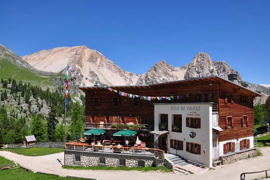 |
| Rifugio Fanes |
Day 2: Rain all day
Sennes to Fanes (3:30 hours, 11 km, 500 m up, 850m down)
The second day was overcast, and there was a constant drizzle throughout the day. The first part of the day took me briefly up a hill behind the Sennes hut, then dropped steadily and precipitously to Rifugio Pederu, into a deep gorge with zigzagging trails and a partially paved road with many tight hairpins next to a tall, imposing rock-face that stood about 700m. straight up. Imposing!
 |
| Did I just walk down that! |
After arriving at the rifugio, knees shaky from all the downhill, I replenished with a quick espresso, Italin style at the bar, in Pederu and set off for Fanes on a trail that climbed and disappeared into a misty saddle. The path first steadily climbed up about 100 m into the saddle.
 |
| That's where I need to go? |
 |
| The cloudy view from Pederu |
Once on the saddle, the terrain became barren and otherworldly and had little vegetation. The path continued past the barren valley and climbed on to a rock-basin. The he trail then meandered along the right-bank of the mountain for a few kilometers, dipped down to a lake, and then climbed steadily alongside a dirt-track into a valley.
After heading into what seemed a steep wall that led to a pass many kilometers and thousands of meters up,
the trail abruptly turned left into a lush valley, previously hidden, and after an hour of steady walking climbed up into to the lush valley that contains Refugio Fanes. It is a tiring day and after walking through a drizzle for 2 hours I am glad to see the refugio.
 |
| The rain-soaked meadows around Fanes |
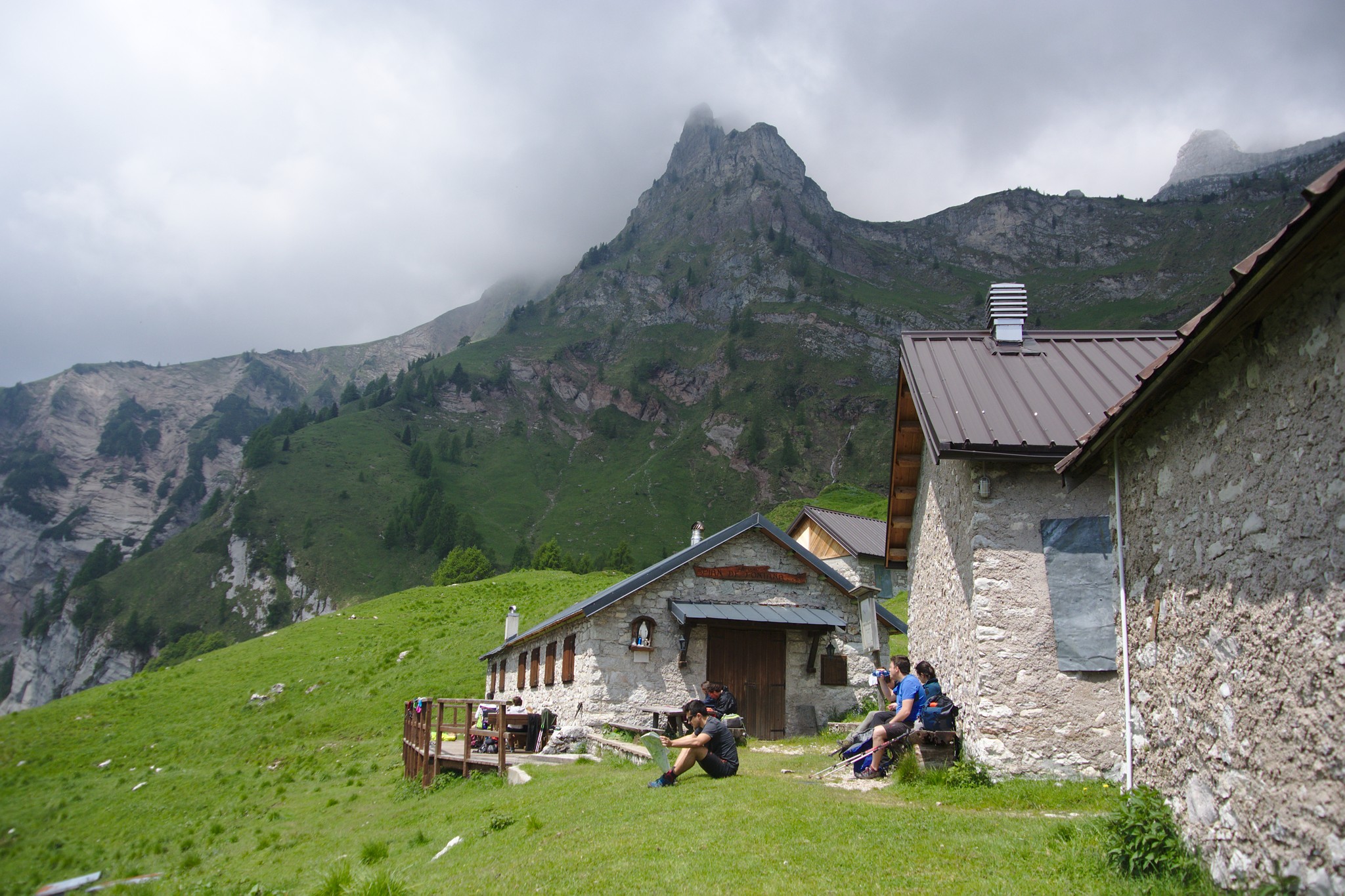
 |
| Rifugio Lagazuoi |
Day 3: A kilometer up
Fanes to Lagazuoi (5 hours, 11 km, 1,100 m up, 400 m down)
Fanes was a lovely, comfortable refuge to unwind and relax. Here I met a trio of fellow travelers from Luxembourg: there were the twins Michelle and Aline and Aline's husband Tom. They were charming and lovely companions for a few days.
After a restful day at Fanes, I set off early the next day. It was still cloudy and grey. The path first climbed for a while to a farmer's hut, Fanes Grande, then the trail spent a hour in a lush valley. It was a lovely morning and the rain-clouds were starting to clear.
 |
| The morning wet path from Fanes |
The trail then sharply turned left and climbed up to a col about 200 m up. From there an unbelievably pretty view opened up. On the left were mountains, in front there was a narrow pass and on the right you could look down into a lush verdant valley circled by the magnesium-limestone pillars of Dolomite.
 |
| Tonnes of scree to walk by |
 |
| A lovely sight of green after an hour of rock and snow |
From there we had to climb another 200 m into a narrow opening in the magnificent limestone pillars towering over us. Once in the pass, we had to walk down very steep scree for 50 m until a path veered off to the left skirting the towers.
 |
| The narrow Pass we have to pass through |
This took us to the middle of a a magnificent valley surrounded by the Dolomite pillars. To our left was the towering Cima Fanis range. If front, perched on top of the mont Lagazuoi was the destination Rifugio Lagazuoi, and behind was a picturesque Lake-Lagazuoi.
 |
| That tiny strip on the scree is a trail! |
From there the trail slowly headed towards Lagazuoi, tantalizingly visible but almost 1 km above. A two and a half hour slog through rocks, scree and snow-flelds finally took us to a col, the Forcella Lagazuoi, above which was perched the ski-station Lagazuoi. Another half hour of dragging a weary body and pack up some zig-zag snow-fields finally took us to Lagazuoi. It was a long, tiring day, and the result of that long slog to the mountaintop rifugio meant that there were magnificent views all around!
 |
| Rifugio Nuvalou |
Day 4: Charming Refugio
Lagazuoi to Nuvolu (5:30 hours, 15 km, 650 m up, 850 m down)
From Rifugio Lagazuoi, we went down to the Forcella Lagazuoi, and then took the path that winds it way around the magnificent pinnacles. Once on the back of the Pelmo, the path winds its way down to the lush Forcella Travenanzes, a lush stream-filled valley with views far down into the valley we had walked up yesterday. From there the path winds its way up to Forcella Travenànzes, a col that goes around the towering walls of the Cima Falzàrego, The path first skirts the massive Cima Falzàrego a pinnacle famous for its rock-climbing and cabled-routes and after an hour we reach the Forcella Col dei Bòs. Here the path continues beneath the beautiful rock
face of the massive pyramid, the Tofàna di Rozes, with its lovely views of the South facing valley.
 |
| The back of the Pelmo |
 |
| The valley behind the Pelmo |

 |
| The magnificent Tifana de Roses we will walk around |
From here the path zig-zags down a bit on a rocky-road, then doubles back to head once again under the magnificent peaks we earlier skirted.
 |
| The Tofana di Roses providing the background for the Cinque Torre |
Just this time we are a couple of hundred meters lower, and at this elevation we are below the tree-line. This path ultimately hits a small road that after going through a tunnel and some hair-pin bends, then passes a farmer's hut and joins a large busy road full of cars, trucks, and weekend motorcyclists.
 |
Lush valleys below
|
At this point Rifugio Nulolu is visible as a speck atop the mountains on the other side of the steep valley. You realize that you need to make your way down the valley, then climb up the 800 ms up to Nuvolou. No small task.
 |
| Thats Rifugio Nulolu there, the tiny speck capping the highest point! |
I also realize I am not in the spot I am supposed to be. I missed a path and while coming down the zig-zags; I has zigged when I should have zagged and am about 2 kms further down the road than I should be. I wearily start ploughing up the road, when I run into a ski-lift. In the hope of adding some caffeinated energy in the form of a Macchiato, I head to the lift-station but unfortunately the cafe is closed. I notice that the ski-lift is however running, and taking it will shave about 400 m of my trek to the refuge. I am quite tired at this point so I jump on to the ski-lift that takes me to a cafe midway up the mountain. This cafe is open and then reenergizing myself with a very refreshing beer, I climb the rest of the 400 m to the charming, rustic Rifugio Nuvolu perched on top of a rock-slab on top of a mountain. The views are spectacular!
 |
| The view from Nuvalou |
 |
| The charming Refugio Nulolu perched on top of a slab-of-rock |
 |
| Rifugio Citta di Fiume |
Day 5: A little too steep
Nuvolau to Citra-de-Flume (5:30 hours, 11 km, 250m up, 950m down)
The day started with adventure. The way down from Nuvolau to the valley far below involves going down two very steep sections. The first involves a short stretch with cables and a ladder. Then we traverse a snow-field strewn basin and make our way down a second via-ferrata.
After the first cable, I met up with the French-foursome in the basin. The snow had covered the markers and the path and the way down was unclear. After wandering around a while, we found a path that led down. While marked, it had no cables and the going got steeper and steeper, until we hit a point where walking down the unstable, steep scree would no longer be safe. We decided to retrace our steps. Luckily in the snow-filled basin above we found a second path to the steep via-ferrata that quickly took us down into the valley. Phew! Was sketchy there for a while!
 |
| Passo Gau |
From the valley below the via-ferrata, a long walk took us to the verdant Passo Giau which is crossed by a major highway populated, this weekend, by many motorcyclists and fit bikers on expensive bicycles. I got myself a coffee there, crossed the highway and continued on the path that wound it way across two large bays occasionally strewn with snow to the Forcella di Zonina. From there, the trail started going up.
 |
| To the Forcella di Zonina on a lovely day |
The trail climbed steeply up for about 45 minutes to the saddle, Forcella Gal, at 2,400m. Turning left after the saddle there is an extraordinary view over the Lastoni di
Formìn, the imposing base of the Croda da Lago, and the pock-marked
stretch of pastureland which goes to the Forcella Ambrizzòla.
Passing under the vertical dolomite walls of the Lastoni, we pass above the clear waters of the
Lago Delle Baste, until we gently climb to the Forcella Ambrizzòla at 2277m. From this wide open saddle paths going off into the next valley on the left. Our path carries on straight and winds its way to the left of a small hill. Once past the hill, we can see down into a large lush valley at the end of which there are two steep gorges going off to the left and right. Half-hour walk along the lush vegetation, past a shelter, the Casera Prendera, takes me to the end of the first valley. The destination, the refugio lies somewhere in the steep valley on the right but there is no sight of it. The path turns right and continues along a small track on the left bank of the steep valley, San Vito di Cadore, alongside meadows and grazing cattle. Towering steeples of rock, the Richotta, appear on the left while the valley plunges down on the right. Suddenly, after 45 minutes of walking, the vegetation opens up and there are terrific views up the pinnacle on the left and the rock-strewn valley on the right. And about 50 m down is the inviting sight of the Rifugio Citta de Fiume, a happy sight for tired legs.
 |
| The Citta de Fiume below the towering peaks of the Richotta |
 |
| Rifugio Tissi |
Day 6: Civetta, the wall of walls
Citta de Flume to Tissi (3 hours, 7 km, 600 m up, 400 m down)
This was the half-way point of the walk, and I was tired from the long walk from day 4. The next Refugio Palafavera on the walk was not yet open as it was too early in the season. I decided to continue on to the next Rifugio Tissi which is about a 7 hour walk. My legs needed an easy day to recuperate from five days of walking. I discover that about 2 1/2 hours of the walk are along roads and that I could skip this bit by taking a cab. So I walked down a rough track for an hour to a road and took a cab to Casera Pioda, the base of the climb to the lovely Refugio Coldai. From the Casera it was an hour and a half of steady uphill, but at the end I arrived at Coldai to lovely views, which looked even better viewed while sipping a cappucino. !
 |
| View from Coldai |
 |
| The path onward from Coldai |
I walked up to the col/saddle that is about 15 minutes up from Coldai from where a lovely view of Lake Coldai opens up. The path dipped down, skirted the lake and heads off left under the mighty Civeta, the wall-of-walls.
 |
| Lake Coldai |
 |
| Lovely lake Cold |
After crossing multiple snow-fields and scree, after a half hour I can see Rifugio Tissi in the distance, perched as a tiny dot on a hill across from the mighty Civetta.
 |
Rifugio Tissi! Can you spot it?
|
Another half hour takes me to the bottom of the hill and a final half-hour climb takes us to the charming Rifugio Tissi with it magnificent views of the huge, imposing Civetta.
 |
| The Civetta next to Tissi |
What a lovely refreshing day!

It turns out that Tissi is perched 1,200 m above a small village from where it gets provisions once a week via a private cable-car. The view from the cable-car shed is spectacularly-steep.
 |
| Our provisions village, a kilometer below. |
 |
| Rifugio Carestiato |
Day 7: Long Day
Tissi to Carestiato (6 hours, 14 km, 600 m up, 600 m down)
It was a long hard day.
I set off from Tissi in good spirits, walked down to the base of the Civetta, and walked along a lovely green valley that steadily went downhill. After about an hour and a half we hit a dirt-trail that zigzagged down and reached the closed Refigio Vazzoler after two hours of walking.
 |
| The steep valley I have to cross |
Then the dirt track opened out into a very steep valley; the track zig-zagged down for a while and on a zig, it headed off to the left down and to the left-bank of the steep valley. From here the path steadily and relentless went up more than 400 m. First the path went through steep woods that reminded me of the Adirondack trails in the US; then the path went up past the tree-line to the first col; from there, the path would its way through a long bay of scree-rock covered with periodic patches of remaining snow, dirty from the many rivers of melt-water that had coursed through it leaving debris and dirt behind.
 |
| Another mountain bay to cross |
The end of this long bay led to yet another bay populated with scree and punctuated with snow. After a lunch-break my tired feet made it to the col that marked the end of the second bay. On the other side lay yet another bay of scree and ice and snow and for the first time vegetation. Through gaps in the vegetation you could see Rifugio Carestiato as a small speck on a hill across from the end of the bay. It felt within hands reach, but it still took an hour of scrambling up boulders, scree and a short steep incline to reach the refuge. At the end of the incline, the rifugio suddenly popped up on the left through the now thick vegetation. A happy sight for tired legs!
 |
| Finally, the rifugio in the distance |
The rifugio was quaint and charming, and had lovely views of the Cima.
 |
| The Cima |
There views were lovely all around.
 |
| Carestiato view |
 |
| From Carestiato |
 |
| The view from the front porch |
 |
| Cliffs all around |
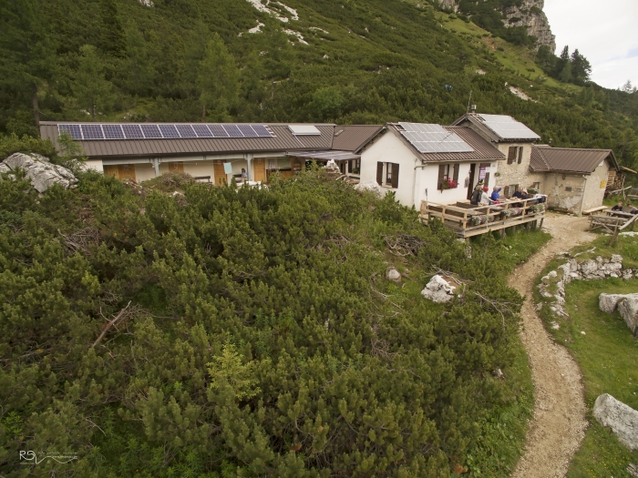 |
| Rifugio Pramparet |
Day 8: Lovely Day
Catestiato to Parampet (5 hours, 13 km, 450m up 450m down)
It was a lovely day of hiking after the tiring walk to Carestiato.
 |
| The path around the Cima |
A 5 hour walk felt very pleasant -I think that my body is getting used to the haul, and my pack is getting lighter as I eat up my provisions.
 |
| Rifugio Pian de Fontana |
Day 9: Marmots
Parampet to Pian de Fontana
(3 hours, 6 km, 550m up, 750 m down)
 |
| The way up. Can you spot the French quartet? |
The penultimate day was short and memorable.
I started off heading down the wrong path. I realize that I am supposed to head uphill and retrace my path to run into the French foursome heading down too. We realize that a signpost was pointing the wrong way and start heading uphill, steeply. Tibou offers me one of his poles, and I will be glad later, when walking through snowfields that I accepted hos offer -I had left my poles behind by mistake at Nuvolau. The path heads up, first through woods, then grasslands, steadily up to the first saddle just above the tree-line.
 |
Cloud capped peaks to walk through
|
Suddenly we are in a lunar landscape that is barren and devoid of trees, of rock, scree and snow, surrounded on three sides by rock-hills.
 |
| I have to walk up there? |
 |
| Rock and Snow! |
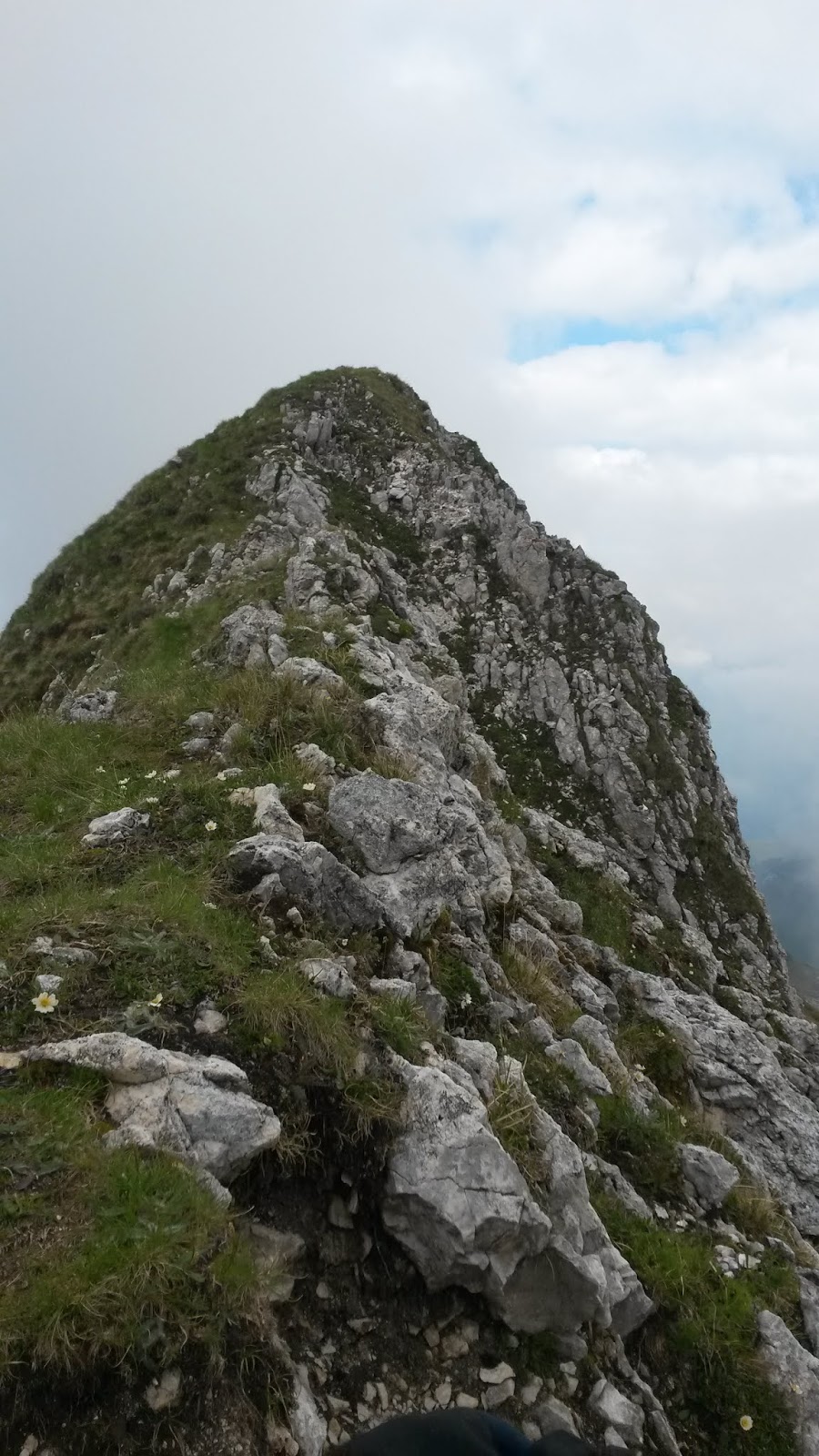
I realize, improbable it may seem, that we need to walk up to one of the saddles between the hills that surround us. The path winds it way up sharply through a zig-zagging narrow path that takes us towards a valley between two rock-peaks. Close to the top, I find myself on a knife-edge ridge about a couple of feet wide with 300 ft steep walls on either side.
 |
| I'm glad its not windy! |
 |
| An exciting 20 yards of walking |
I walk up the knife-edge (carefully) to the precipice. Boy, am I glad that there is no ice or wind.
The trail, just before the peak, veers off to the right, cuts to the other side of the knife-edge and wanders along the side of the rocky mountain to yet another saddle.
Then a hour of walking very steeply downhill first through green bush, then on thick grass carpeting red-earth and on stone brings our tiring legs to the charming and rustic Pian de Fonatana, with its cowshed-like sleeping hut that houses 13 on two floors. How much a small, innocuous hut can contain.
 |
| The rifugio is down below |
Tis only 2 PM, and I spend the rest of the leisurely afternoon on the porch outside my room at the refugio, gazing at the surrounding mountains with the sun playing hide-and-seek! What a lovely day!
 |
| The lovely Rifugio Pian de Fontana |
 |
| That sleeps 13 people! |
 |
| Trusted pole and pack at trek's end |
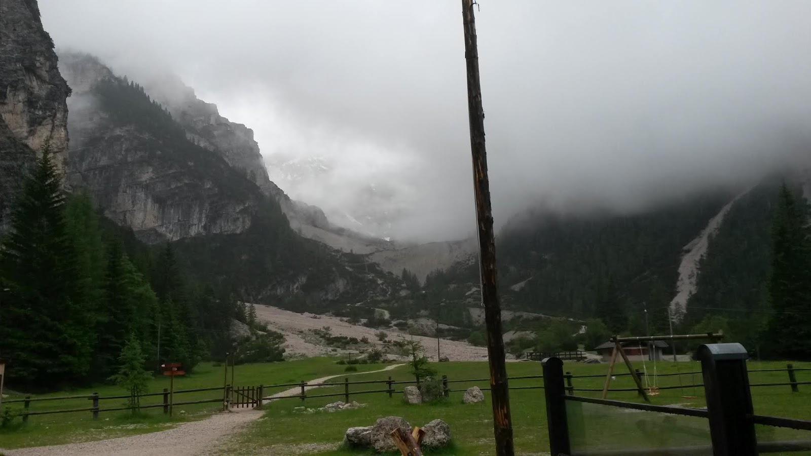
Day 10: Pools of azure
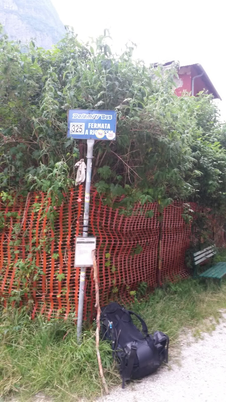
Pian de Fontana to Passes bus-stop (4 hours, 16 km, 300 m up, 1,250 m down)
The last day of the trek throug the Dolomites wasremarkabe as it involved an early-morning plunge down into a valley and up 200 m to a beautiful grassy col/pass at 1,700 m. From there a precipitous path along the side of mountains so steep, hat it had you cautiously peering down took you to down into mountain woods, and after an hour to the oasis of Rifugio-Bianchet, which the caretaker Enzo aptly described as "
paradise": it was a beautiful summer day with clear skies, perfect temperature, not a soul in sight, surrounded by soaring mountains.
 |
| The view from "paradise" |
After a coffee with Enzo, I headed down the last 10 km, that would take me down the rest of the 1,200 m to the bus-stop.
 |
| The end of the trail |
After two weary hours, I finally sighted the road and bust-stop but not without a lovely surprise: a
waterfall and emerald pools under.
 |
| Lovely waterfall with emerald-pool |
What a lovely way to spend 10 days: a 120 km trek down the lovely Dolomites!


